Place & station ID
Search address or city, or jump by station identifier when you have it.
 PlugLocate
Nearby stations with filters that stick. See food and places while you charge. Plan chargers along your trip. When you sign in, check live ports from TomTom on supported stations — before you divert.
Outofbox Solutions Privacy Terms support@pluglocate.app
Product
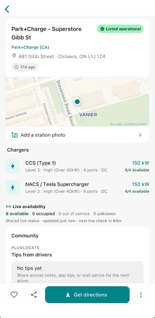
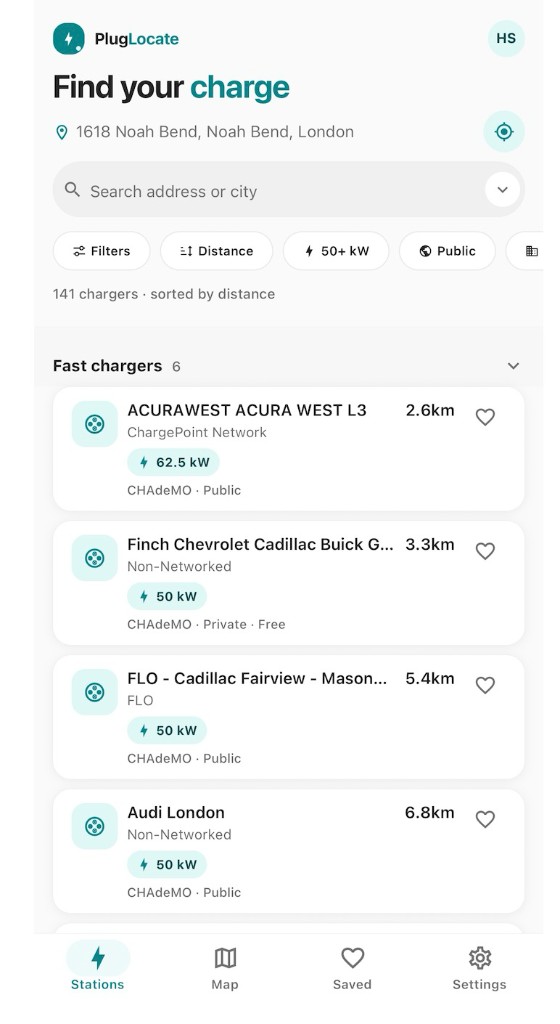
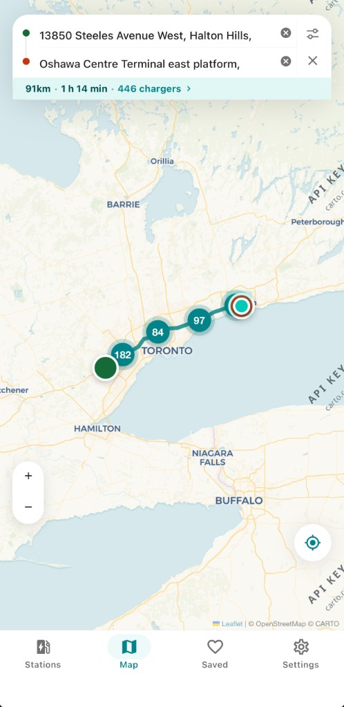
Real PlugLocate screens — Stations list, live station detail, and trip corridor map.
Explore
Browse nearby chargers on Stations or Map with the same filters. Recenter on your location, search an address or city, and open a station card when you are ready.
Quick chips for Filters, Distance, 50+ kW, Public — plus full plug, power, access, facility amenity, and network controls. Walkable food and places live on station detail under Nearby, not only in these filters.
Search address or city, or jump by station identifier when you have it.
NACS, CCS, J1772, and more — plus min kW targets that match how you actually charge.
Popular networks and presets like road trip or daily commute. Sync your plugs when signed in.
Trip
Switch Map into trip mode, set origin and destination, and see filtered chargers on the route — with distance, duration, and charger count. A planning aid, not a navigation replacement.
Live status
On supported stations, signed-in drivers can check live connector availability — available, occupied, and more — powered by TomTom through our backend. On demand only; not every station has live data.
Nearby
On station detail, Nearby lists walkable spots around the charger — food, restrooms, shops, and services — sourced from OpenStreetMap. Tap a place for walking directions so you can make the most of charging time.
Browse as a guest. Sign in for favorites, tips, photos, ratings, and live port checks.
Email with in-app OTP, or Sign in with Apple or Google. Manage profile and delete your account from Settings.
Save chargers to Saved, leave PlugLocate tips, upload station photos, and share how a stop went.
PlugLocate is an EV charging discovery product from Outofbox Solutions. We help you find and compare stations. We are not a charging network operator and do not control stations, pricing, or availability.
Straight answers for drivers — and for Ads / store reviewers.
Yes. Browse list and map, search, filter, plan a corridor, and use Nearby places as a guest. Sign in for favorites, tips, photos, ratings, and TomTom live ports.
No. Live ports come from TomTom for signed-in users, on demand, only where a matching station exists.
Yes. Station detail includes Nearby — walkable food, restrooms, shops, and services from OpenStreetMap, with walking directions. Coverage varies and is not live business hours.
No. We help you discover chargers and plan a corridor. Open Apple or Google Maps for turn-by-turn directions.
No. Outofbox Solutions builds PlugLocate as a discovery product. We do not run networks or set pricing.
Station catalogs include NLR / AFDC-derived data and Open Charge Map. Nearby places use OpenStreetMap. Live port checks use TomTom where available. See our Privacy Policy for details.
Free on the App Store and Google Play. Find your charge — filters, Nearby places, trip corridor, and TomTom live ports where available.